






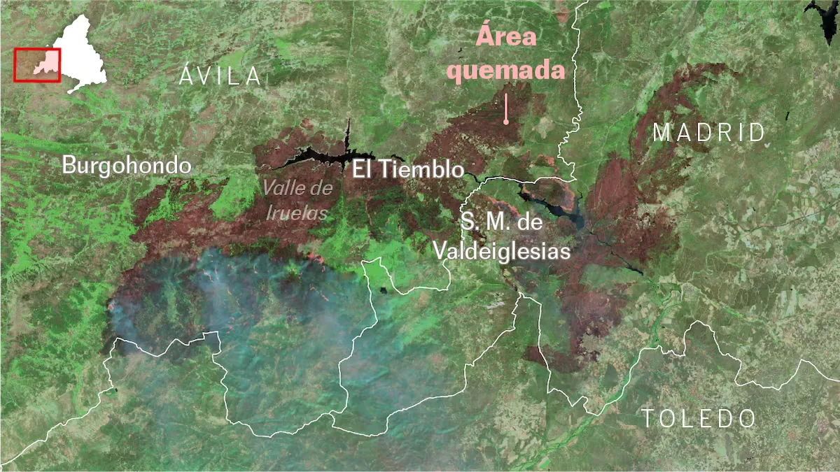
The more than 45,000 hectares burned by the Burgohondo (Ávila) fire are perfectly visible from satellites. In the map at the top of this news, you can see the image taken at 1 p.m. on Sunday with short-wave infrared (SWIR): a band of the spectrum invisible to the eye that penetrates the smoke and highlights the active fire and the burned terrain. To the right of the image, the fires of the Sierra Oeste, started in the Community of Madrid, covering more than 19,000 hectares. The heads of both fires have joined near the San Juan reservoir.
The wind has been key in the evolution of both fires and in the change of direction of the larger one, the Burgohondo fire. The following image shows how it was seen from the sky on the afternoon of Friday, July 24 (very obscured by smoke: by clicking the button you can see the infrared version). The fire had started south of the town of Ávila and the strong wind had pushed it eastward.
On Saturday the fire “turned around”: it began burning the area southwest of where it had started, forcing the evacuation of dozens of villages and threatening the Tiétar valley.
The following graph shows that wind shift in the Navaluenga area, near where the first flames originated. We have created it based on data from Open Meteo, which uses information from the European Centre for Medium-Range Weather Forecasts (ECMWF).
The wind started on Friday from the southwest, pushing the flames from Burgohondo towards the east and crossing a heavily forested area. The smoke reached the city of Madrid hours later. Throughout the night, the wind origin rotated clockwise: the burned area shifted to the south, towards the Tiétar valley.
Read more Chess Videos | Erdogmus’s Genius at 14 Years Old
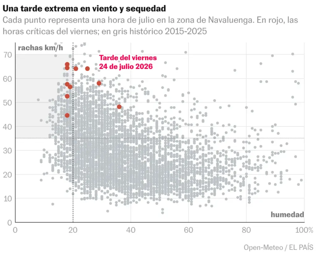
Friday’s wind was exceptional. It grew especially in the afternoon, as there were hours of wind and humidity close to record levels for this time of year. As a result, between Thursday night and Friday night the fire doubled: it went from 7,000 to more than 14,000 hectares, according to measurements taken at those times by satellites.
The following graph shows how the gusts recorded between 1 p.m. and 8 p.m. on Friday are unusual for the Navaluenga area. Strong wind, low humidity, and temperatures above 30 degrees, as were especially on Friday, form the perfect cocktail for fire spread.
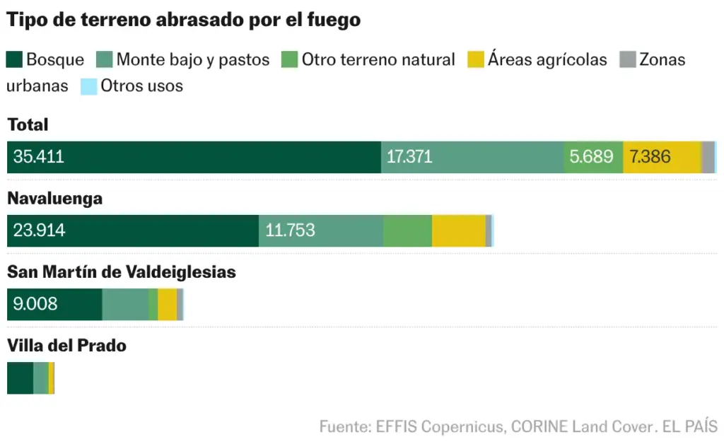
The fire’s advance has also been so effective due to the amount of forests and scrubland covering the area. In fact, 53% of what has burned so far is forest. At least 35,000 of the more than 67,000 hectares burned between the two fires (Burgohondo and Sierra Oeste) were forest, according to EFFIS analysis of the burned perimeters up to early July 26 and the CORINE Land Cover cartography.