









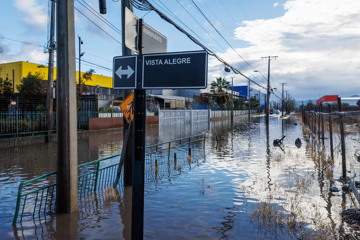
Chile receives a new frontal system this week. The South American country, which has been under climatic instability for over a month ranging from heavy rain pulses to very high winter temperatures, is preparing for a new series of bad weather fronts that will reach Santiago, the Chilean capital, this Tuesday with more precipitation. The official forecast indicates that the storm, which extends along the central and southern zones of the territory, will last at least five days and arrives with an atmospheric river bringing strong winds to the mountainous areas.
Read more Macron announces three “Disneyland-like” parks in Paris funded by Saudi Arabia
The El Niño phenomenon has been behind the extreme weather in recent weeks in Chile. The storms have hit hard at least 14 of the 16 regions of the continental territory. The latest major bad weather front has affected the regions of Arica and Parinacota, Tarapacá, and Antofagasta in the far north, where a segregated low caused unusual rains for an area usually dry and generated mudslides that destroyed homes and roads. Other areas of the country that have suffered from previous frontal systems include Atacama, Coquimbo, Valparaíso, the Metropolitan region, O’Higgins, Maule, Ñuble, Biobío, La Araucanía, Los Ríos, and Los Lagos.
When will it rain in Santiago?
The Chilean Meteorological Directorate (DMC), the official entity responsible for providing the weather forecast, indicates that starting Tuesday afternoon, August 25, some showers [light rain] will fall. The specialized site Meteored, which has considered the European Centre for Medium-Range Weather Forecasts (ECMWF) model as its main source, has said that precipitation will reach the central valley and accumulate between 1 to 4 millimeters in central Santiago.
Until when will it rain in the capital?
The DMC forecast indicates that on Wednesday, August 26, the skies over Santiago will be overcast with showers. On Thursday, August 27, the day will have cloudiness with light precipitation falling in the afternoon. According to this forecast, the rain will stop on Friday, August 28. The American GFS model is less conservative regarding the duration of the rain, estimating that precipitation will extend from that Friday through Saturday, August 29.
How much will it rain in Santiago
This frontal system, unlike the one that affected the Chilean capital in July, will have irregular rain pulses, so there will be daily pauses without precipitation. The second part of the bad weather front train will arrive on Wednesday, with precipitation reaching amounts of 10 millimeters. In the three to five days of the storm, about 30 millimeters will accumulate. The frontal system will affect the pre-mountain range of the Metropolitan region more strongly, with wind gusts reaching up to 100 kilometers per hour. The zero isotherm — the altitude at which the air temperature reaches 0° — will initially reach 3,000 meters but will drop during the week, which will favor snowfall on the hills near the Andes mountain range.
In which other regions will there be precipitation
The DMC indicates that precipitation will reach the regions of Valparaíso, O’Higgins, Maule, Ñuble, Biobío, and La Araucanía. The agency has issued a warning for normal to moderate precipitation between Maule and Biobío, which will extend from this Tuesday until Wednesday morning, with rains mainly affecting the coastal zone and valleys with maximum amounts between 30 to 45 millimeters. There is also a warning for normal to moderate wind between Coquimbo and Biobío, with gusts that could reach up to 80 kilometers per hour in the Ñuble mountain range.
What is an atmospheric river
An atmospheric river is an extensive band of water vapor that moves through the atmosphere, transporting large amounts of moisture from tropical or subtropical zones to higher latitudes. This band does not generate precipitation, but when it encounters a frontal system, it can cause intense rain or snowfall. Its magnitude and damage capacity are measured with the Ralph scale, with categories ranging from 1 to 5, where Category 1 is “Weak” and Category 5 is “Mainly dangerous.”
Read more Ryan spoils Ramis’ debut at Osasuna with his saves