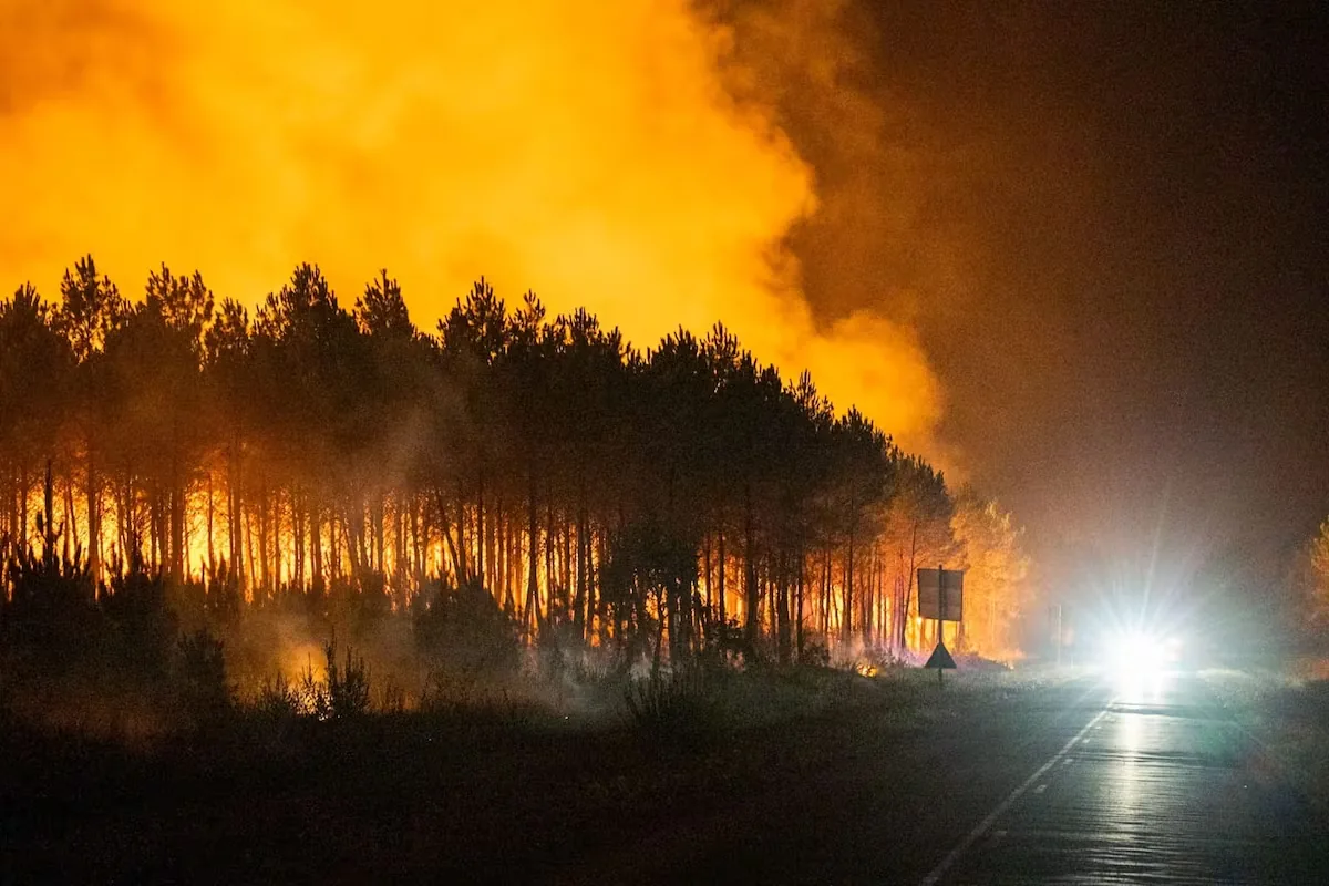




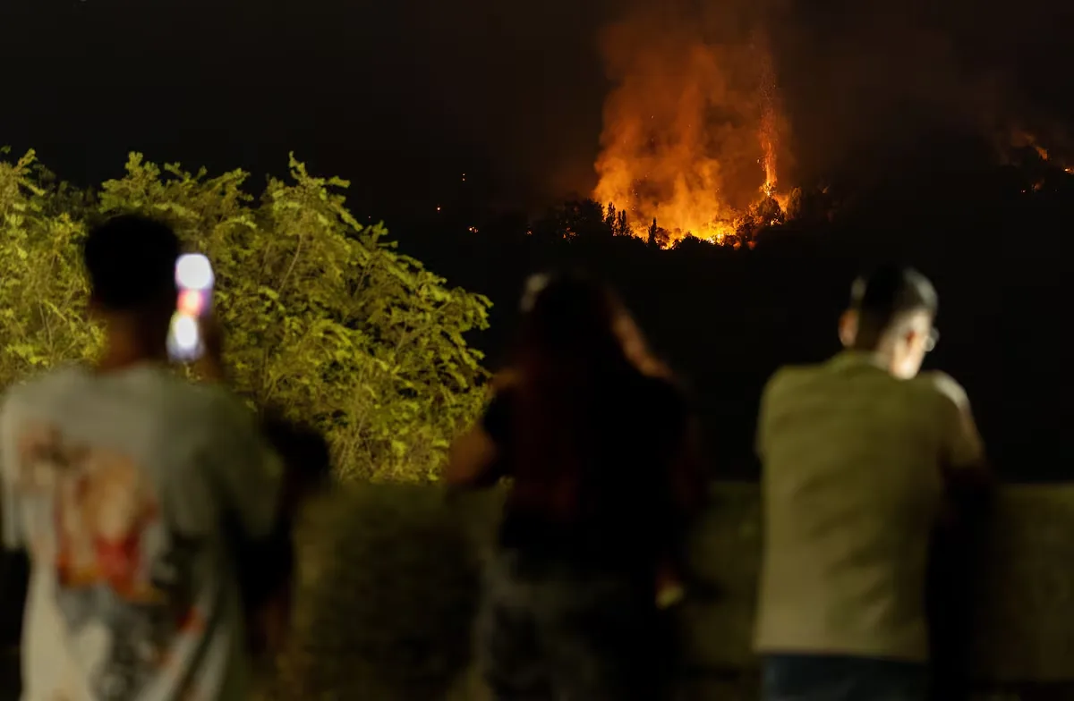
The large fire in Ávila and Madrid, which the technicians in charge of extinction efforts have been contemplating and attacking since Saturday at an operational scale as a single fire, although for now they have not yet merged, is of such magnitude, with 77,000 affected hectares, that it has already made the leap to a stratospheric level: that of structures capable of altering the weather. “A fire, if it is intense enough like this one, generates a heat source that changes the local meteorology,” explains meteorologist Daniel Santos Muñoz.
Read more The anguish of a woman in the new command post: “I am here to ask for help from anyone”
Javier Armenteros, delegate of the State Meteorological Agency (Aemet) in the Community of Madrid, began observing certain features on Saturday that suggest the fire has become a sixth-generation fire, which is what fires are called when, due to their dimensions, they acquire superpowers: the ability to create their own meteorological dynamics. “On Saturday, several videos were already circulating showing that the fire generates its own convective phenomena,” he explains by phone to EL PAÍS. Thus, the fire produces, for example, dangerous thermal bursts.
A burst is an abrupt, sudden, and extreme phenomenon of strong wind that falls and hits the ground like a violent slap. This gust of wind, which spreads in all directions as it collapses, is usually caused by a storm — in this case by the extremely high temperatures — and has a very local scale, no more than 10 kilometers. It can reach the intensity of a tornado, with gusts of 80 to 100 kilometers per hour, causes sudden temperature changes, wildly alters humidity, and lasts a short time, between five and 30 minutes. “Being a very local phenomenon, it is very difficult to predict. The only thing we can know is that the conditions for it to occur are present, but not when or where; we cannot be precise,” confesses the meteorologist, pointing out that on Saturday “the conditions were very conducive to bursts.” This Sunday they are less so, “but they can still occur, especially in the afternoon.”
⏰20:30h ⚠️🌬️ What a real air burst in Casavieja (#Ávila) #IFBurgohondo. This is impossible.. pic.twitter.com/IfSfpGEQtr
— MeteoÁvila (@Meteoavila2) July 25, 2026
But there’s much more: it creates clouds. “A large fire can develop a cumulus-type cloud, those that are cauliflower-shaped, which, when originating from a fire, are called pyrocumulus. If it is large enough, it can generate lightning and strong local winds, that is, a dry storm generated by the fire itself, which in turn fuels the flames and can start new fires,” explains Santos Muñoz. In addition, fire clouds form a very high column, which disperses and propagates large amounts of smoke and ash over long distances, a grayish haze that is very harmful to health. “Air quality is very poor throughout the Community of Madrid, in a large part of Castilla y León, and even in Castilla-La Mancha,” the expert recalls.
These colossal fires acquire a life of their own that goes beyond time. According to the experts consulted, it is very likely that the Madrid fires merged into a single one because the air currents caused by the heat make nearby fires attract and merge. Even “the fires of Madrid and Ávila are interacting at a distance, complicating each other,” explains Armenteros. Thus, on Saturday, the Ávila fire was feeding the Madrid one by launching embers or sparks southward.
#ifBurgohondo preparing the impact Casavieja , @brif_iglesuela and @bomberosdeavila , together with other means pic.twitter.com/eEFprX95Xv
Read more Hungarian GP live, the F1 race live
— BRIF Puerto el Pico (@brifpuertopico) July 25, 2026
In the first few days, the meteorological conditions were “extremely difficult,” which has led to the ungovernable monster it has become. “This Sunday, the fire danger is moderate — level three on a scale of six — whereas, on the days it broke out and grew, it was extreme, the maximum,” indicates the Aemet delegate. Thus, this Sunday is, from a meteorological point of view, the most favorable day to fight the flames, tomorrow Monday “somewhat less,” and from Tuesday onwards, things will get complicated again, with yellow heat warnings already decreed for that day or which may even reach orange on Wednesday, which will cause humidity to plummet.
The monster was conceived and evolved with everything in its favor, the famous 30-30-30 rule: temperatures over 30 degrees, humidity below 30%, and winds above 30 kilometers per hour. “These conditions are the most adverse; on Saturday there was an improvement, and today they will be even better,” contextualizes the Aemet delegate. The day to attack the flames and be able to perimeter the fire is this Sunday, as the wind finally eases. Aware of this, the head of the UME’s First Emergency Intervention Battalion, Lieutenant Colonel Alfonso Arriba, announced early on TVE: “Today we hope to be able to dedicate ourselves much more to direct attack on the fire.”
During the early hours of the morning, strong gusts of north wind, over 40 kilometers per hour, occurred on the peaks of the Ávila mountains. However, for the rest of today, the wind is expected to be “weaker, and although generally from the north, there may be moments when it changes direction.” These sudden shifts are difficult to predict. “Fires develop in mountain areas, known as complex orography, where prediction models have considerable difficulty working with wind given the high resolution needed to resolve so many details such as peaks, ridges, hollows, valleys, slopes…”, explains Santos-Muñoz, an expert in supercomputing applied to meteorology.
As for temperatures, there will be a moderate rise in maximums, leaving values between 31° and 33°. On Saturday, thermometers stayed below 30°. And the third key is humidity. On Saturday, it was generally around 30% but rose to 60% at night, which undoubtedly helped firefighters contain all fronts of the fire. “In the central hours of this Sunday, humidity could drop to 20%,” Armenteros points out.
In summary, “conditions are more favorable than in past days, due to the decrease in wind intensity.” The problem may lie in changes in direction, which can be very local. “But it must be taken into account that, although the general meteorology will help with extinction efforts, the meteorology of the fire itself will not. The magnitude of the fire is such that it disturbs the entire environment and creates its own meteorological conditions, and these are unpredictable,” concludes Armenteros. “The fire has grown so much that, honestly, we don’t know how it will behave,” he assumes.