








On October 6, 1970, the deep-sea drilling vessel Glomar Challenger returned to the port of Lisbon, Portugal, with a cargo that would change history. During its 54-day voyage, the Challenger had drilled 28 holes in the bottom of the Mediterranean Sea. The recovered samples pointed to a surprising conclusion: about 6 million years ago, the sea had become a desert—a vast, arid, saline basin more than two kilometers deep. Half a million years later, the Atlantic Ocean burst through what is now the Strait of Gibraltar and unleashed the greatest flood in history.
Read more With ‘Barrio Esperanza’, TVE moves between remarkable and failing
Kenneth Hsü, oceanographer and one of the two lead scientists of the Challenger expedition, vividly imagined the scene in the December 1972 issue of Scientific American: “With a drop of 10,000 cubic miles per year, the Gibraltar Falls would have been 100 times larger than Victoria Falls and 1,000 times larger than Niagara Falls… What a spectacle it must have been for African ape-men, if any were drawn to the thundering roar.”
The story of the catastrophe was a hit: David Attenborough filmed a documentary about it, and Gibraltar even issued a 5-pence stamp depicting the “3,000-meter waterfall.” The two hypotheses—the first, that the Mediterranean Sea was isolated for a period of half a million years known as the Messinian Salinity Crisis, and the second, that it was refilled after a massive deluge through the Strait of Gibraltar, dubbed the Zanclean Flood—have been the conventional belief among geologists for over 50 years.
However, new doubts have recently emerged about all aspects of this story, from the mega-desert to the mega-Niagara. Many geologists have advocated for a much shorter desiccation followed by a much more gradual refilling of the Mediterranean. Some believe the Mediterranean never completely disconnected from the Atlantic. “The idea of a megaflood, and the data supporting it, are mostly wrong,” says Guillermo Booth Rea, from the University of Granada, Spain.
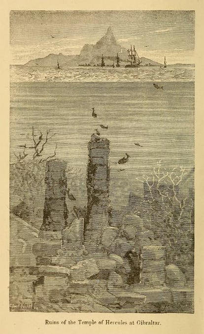
The most surprising recent twist is that the outflow channel, if it existed at all, may not have been anywhere near the current Strait of Gibraltar, which separates southern Spain from Morocco. New research suggests we have been looking for signs of a megaflood in the wrong place for 50 years.
A geological enigma
In the present-day Mediterranean, approximately three times more water is lost each year through evaporation than is recovered from rainfall and rivers. The Atlantic makes up the difference, supplying a constant current of seawater from west to east through the Strait of Gibraltar. As seawater evaporates, the remaining water becomes saltier and denser and sinks to the bottom. The dense water flows back out of the strait, from east to west, beneath the less dense incoming water. This outflow prevents salt from accumulating in the Mediterranean.
But what if the strait narrowed or closed completely? Given the enormous freshwater deficit, the “sea level” in the Mediterranean Sea would drop rapidly, by up to a kilometer in 2,000 years. Such a scenario would have seemed like science fiction until the Glomar Challenger expedition in 1970.
At the first drilling site, the Challenger’s drill bit got stuck in a very hard layer 200 meters below the seabed. The next day, Hsü and his co-chief scientist, William Ryan, from the Lamont-Doherty Earth Observatory, discovered why. “He pulled up buckets full of gravel,” Ryan says.
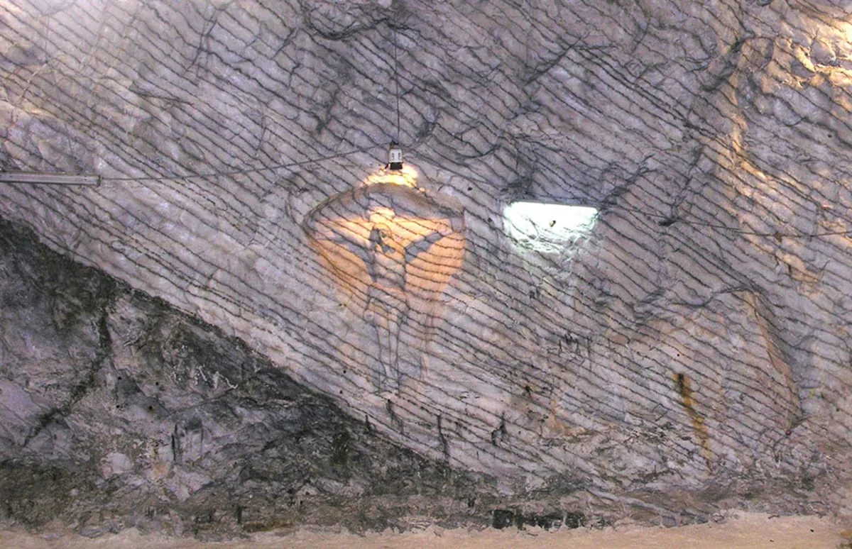
Seabeds do not usually contain gravel layers, and when they do, it is typically continental rocks washed down from adjacent land. But this gravel contained marine fossils and rocks, mixed with gypsum crystals. Geologists call gypsum an “evaporite” because in today’s world it forms in shallow, evaporating bodies of water—like the Dead Sea, for example. The implication was startling. “When Ken held up the gypsum crystals, he turned to me and asked, ‘Do you think the Mediterranean dried up?’” Ryan recalls.
The same story was repeated at every stop. Ryan and Hsü found other evaporites such as halite (sodium chloride, also known as table salt). Oxygen isotopes from marine shells embedded in the gravel suggested that these unfortunate animals had lived in a brine from which 90% of the original water had evaporated. Hsü and Ryan also gathered evidence that the collision of the African and Eurasian tectonic plates had uplifted land at both ends of the Mediterranean Sea, closing its ancient connection to the Indian Ocean and narrowing the connection to the Atlantic Ocean.
The decisive evidence came to light after the Challenger mission ended. Other geologists discovered what appear to be ancient buried beds of several rivers flowing into the Mediterranean, particularly the Nile and the Rhône. It seemed as if these rivers had flowed into the Mediterranean at least a kilometer below their current mouths—something that would only be possible if the Mediterranean Sea level had been a kilometer below global sea level at some point in the past—.
In 1973, a meeting held in Utrecht, Netherlands, established the desiccation model as the consensus theory. However, numerous discrepancies have emerged in the last 20 years. “In the 1970s, the desiccation proponents won the debate,” says Wout Krijgsman, from Utrecht University, “but there are several aspects they really cannot explain.”
Paradoxes in abundance
In part, the discrepancy reflects a better understanding of what was happening on Earth and in the area 6 million years ago. Since 1973, the story told by rocks, geological cores, and seismic surveys—and, increasingly, computer simulations—has become more detailed and dynamic, with changing coastlines, land bridges, volcanoes, and repeated episodes of climate change.
Furthermore, the desiccation hypothesis presented fundamental problems from the outset. Take evaporites, for example: they don’t necessarily have to form through evaporation, says sedimentologist and stratigrapher Vinicio Manzi, from the University of Parma (Italy). They can also form by precipitation from a sufficiently concentrated brine. This can occur underwater, so it’s not necessary to postulate that the Mediterranean completely dried up.
And the buried riverbeds? Manzi and his colleagues can explain that too: the sinking of salty water can produce downward currents (“dense shelf water cascades,” in geological jargon) strong enough to carve a canyon.
The idea of a single evaporation event also faces a mathematical problem: the existing salt deposit is too large to be explained by a single evaporation event. It represents about 5% of the world’s ocean salt (and may originally have been 7 to 10%). To accumulate so much salt, the Mediterranean would have had to empty and refill about 10 times.
Indeed, evidence from salt deposits in Sicily suggests that something like this actually happened. There, gypsum beds alternate with organic-rich shale beds that could have formed during periods when the gateway between the Atlantic and the Mediterranean was open. There are 16 beds in total, with ages separated by about 23,000 years.
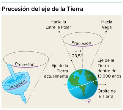
This periodicity is well known to geologists: it is the time it takes for the Earth’s axis (like a wobbling top) to trace a complete circle. And it correlates with ancient climate changes and sea levels across the planet. Given that the supposed Gibraltar gateway was so shallow during this period, sea level fluctuations due to this “precessional cycle” could have repeatedly opened and closed the connection between the Mediterranean Sea and the Atlantic.
That period of gypsum formation is now called “stage 1” of the salinity crisis. Stage 2 was a relatively brief 50,000-year period during which (according to the majority view) the gateway closed completely, the Mediterranean Sea level plummeted, and enormous deposits of halite (sodium chloride) precipitated from the seawater. However, Manzi’s group strongly disagrees, arguing that the Gibraltar gateway remained open but became so shallow that water flowed through it in only one direction—inward, but not outward—leading to an uncontrolled accumulation of salt.
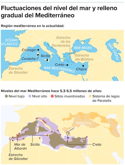
Even for proponents of the majority view, stage 2 is not as straightforward as it seems. Chlorine isotope data suggest that the flow decrease was not uniform. At its lowest point, in the western Mediterranean, sea level was 800 meters below its current level, while east of present-day Sicily it was at least twice as deep. If so, the eastern and western parts must have been separated by a land bridge. Indeed, there is evidence that African animals crossed into Europe during this period.
The last 200,000 years of the salinity crisis, dubbed stage 3, have been the most puzzling of all. Halite stopped precipitating, and there is evidence that during this period there was a wide variety of sea levels in the Mediterranean. Widespread fossils of a shrimp-like animal called an ostracod suggest that the waters became much less salty, so the Mediterranean was a sea-sized lake (in fact, this stage is sometimes called the Lago-Mare stage). But if the gateway to the Atlantic was still closed, where did the fresher water come from?
A 2025 paper by Daniel García-Castellanos, from Spain’s Higher Council for Scientific Research, helps solve the enigma. Using a computer to model erosion, he argues that the Mediterranean gradually refilled during stage 3. The ostracods provide a clue about the origin. They originated in the area of the present-day Black and Caspian Seas, which at that time were connected to each other, but not to the Mediterranean.
Given that the Mediterranean coastlines were newly exposed and very steep, their edges would have eroded rapidly towards the present-day Black Sea, which at that time was a much larger freshwater lake called Paratethys. The first connection between the two could have been established at that time. If so, the Mediterranean began to receive waters from rivers like the Volga, Don, and Danube, which were previously unavailable. The ostracods gained a new home, and the Mediterranean gained a vast new water supply that, according to computer simulation, raised its surface to 300 meters below its current level.
According to Krijgsman, this interpretation conveniently reconciles the contradictory evidence. “In the struggle between a desiccated and a full Mediterranean,” Krijgsman says, García-Castellanos’s paper serves its purpose “if one wants to sit in the middle and give credit to everyone for their observations.”
What’s missing: a megaflood
The literature on the Messinian Salinity Crisis is very extensive, but something is conspicuously absent. Surprisingly, there is very little direct evidence of the megaflood that supposedly ended the crisis. Hsü’s original Scientific American article dedicates only half a page to it and provides little evidence. Fifty years later, Ryan wrote a 100-page retrospective; only three pages discuss the megaflood. Shouldn’t this extraordinary flood have left very clear traces?
Current evidence is, at best, ambiguous. Geologists have found submerged flood-like deposits off Malta, but that is far from Gibraltar, the supposed source of the flood. Furthermore, if the Atlantic drained into a nearly empty Mediterranean basin, then global sea levels should have dropped by about nine meters—an anti-flood to compensate for the Mediterranean flood. There is no indication that this happened, says García-Castellanos.
A recent deep-sea drilling expedition to the Strait of Gibraltar has raised more questions than answers. In December 2023, the JOIDES Resolution, successor to the Glomar Challenger, revisited the Alboran Sea, immediately east of the Strait of Gibraltar. If the strait is the gateway to the Mediterranean, then the Alboran Sea is the antechamber. Any megaflood that passed through the Strait of Gibraltar would also have passed through the Alboran Basin. But Rachel Flecker, from the University of Bristol, England, co-leader of the expedition, states that they found no traces of the flood in the cores they collected.
While still on board the ship, she wrote that the cores were “exquisitely laminated in a variety of colors. This incredibly fine lamination requires very calm, low-energy conditions.” Exactly the opposite of a megaflood. The final results are yet to be published, but Flecker also reports that they found no salt layers or evidence that the salinity crisis had ever affected the Alboran Sea.
“The connection between the Atlantic and the Mediterranean before and during the Messinian Salinity Crisis did not occur via Gibraltar,” she concludes.
How is that possible? “One feature to keep in mind, and which almost no one considers, is that the current physiography of the Mediterranean is very different from that of the Messinian,” says Booth Rea. “Since then, large basins, such as the Tyrrhenian, have opened, and other regions, such as Sicily, have emerged.” One possibility, he suggests, is that the gateway was somewhere to the east, through a volcanic arc of islands that once connected Africa to the Balearic Islands. Other possibilities include channels through Spain or Morocco, which are now above sea level, but were submerged as recently as 7 million years ago.
Regardless of how it happened, this modern view of history teaches us a lesson: it emphasizes the power not of dramatic events, but of small changes. “Salt giants”—that is, enormous salt deposits like the one found beneath the Mediterranean—have formed at other times in Earth’s history, when basins became trapped between two tectonic plates. Their effects on climate and biodiversity are likely to have been enormous: in this case, 89% of marine species unique to the Mediterranean went extinct.
And a slight flattening of the Strait of Gibraltar (or whatever the true gateway was) might be all that was needed to trigger these enormous changes. “In a sense, this is more terrifying,” says Manzi, because it shows that “extreme conditions can be reached without extreme events occurring.”
This article originally appeared in Knowable in Spanish, a non-profit publication dedicated to making scientific knowledge accessible to everyone.
Read more Spain’s largest wetland is intentionally dried just one month after record rainfall