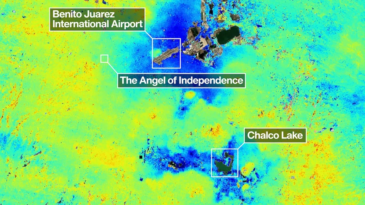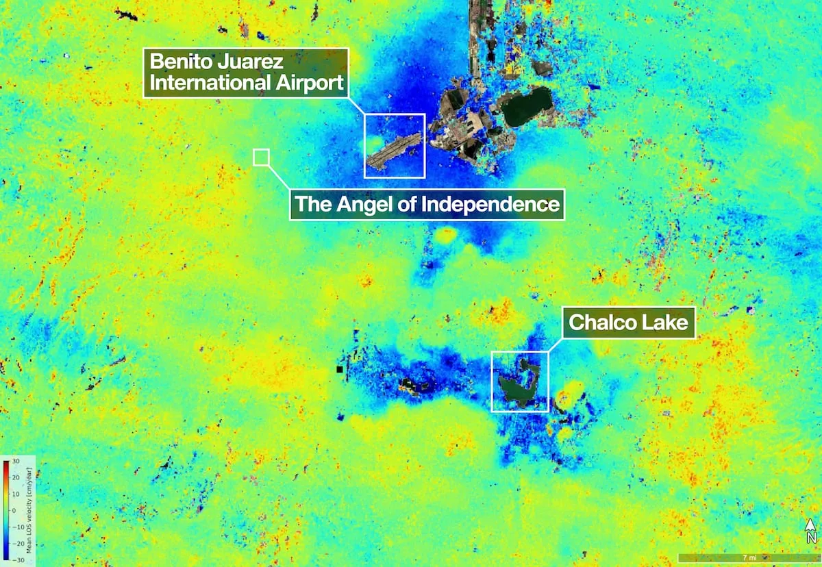









Mexico City is sinking, but the data recently published by NASA do not point to a drastic change, according to Mexican scientists. The images captured by NISAR — a new synthetic aperture satellite developed by NASA and the Indian Space Research Organisation (ISRO) — correspond to tests to validate the instrument’s accuracy, and have confirmed information that has already been widely documented by researchers in the country.
Read more Petro oficializa su campaña por una Asamblea Constituyente en su último discurso un Primero de Mayo
The Mexican capital is one of the cities with the highest sinking rate in the world. Built on an aquifer and ancient lakes, groundwater extraction and the weight of the city have compacted the soil for more than a century. In the most affected areas, the ground sinks at rates exceeding 40 centimeters per year. For reference, studies have documented that Los Angeles records subsidence of up to 20 centimeters annually, while Tehran reaches about 30 centimeters per year.
However, rather than a recent acceleration in Mexico, specialists point out that it is a sustained behavior. “In research with several satellite missions, with GPS, with leveling benchmarks, and more conventional topographic methods, a linear trend is seen, it is not accelerating. The expectation is that the city will continue moving at the same rates recorded in the last 100 years,” explained Dr. Darío Solano Rojas, a scientist at the Faculty of Engineering of UNAM, to EL PAÍS. “Los Angeles is sinking, the San Joaquin Valley is sinking, the Santa Clara Valley is sinking, it is not an exclusive problem of Mexico City, it is more dramatic here, but it is a relatively slow phenomenon. It is not that now (NASA) is reporting that there was a drastic change,” he added.
Currently, monitoring of subsidence in the Metropolitan Zone of the Valley of Mexico is carried out with the Sentinel-1 satellites of the European Space Agency, a mission with more than a decade in operation. The arrival of NISAR provides a complementary acquisition geometry, which will allow combining data from both systems and improving the accuracy of measurements, an advance that the scientific community in Mexico considers promising. “There are many stakeholders interested in mitigating this process and it will take time. The important thing is that this type of work helps raise greater awareness both in society in general and the Government to address this situation. This is our task for the future, although in reality we cannot reverse it due to the physical characteristics of the aquifer and the aquitard under Mexico City,” said Dr. Enrique Cabral, a researcher at the Institute of Geophysics of UNAM, to this newspaper.
Cabral is part of a team of researchers participating in a project of the Secretariat of Education, Science, Technology and Innovation (Sectei), which includes a network of GPS stations to study subsidence, as part of efforts being developed in the country to better understand it and try to mitigate it.
The human impact on the city’s sinking
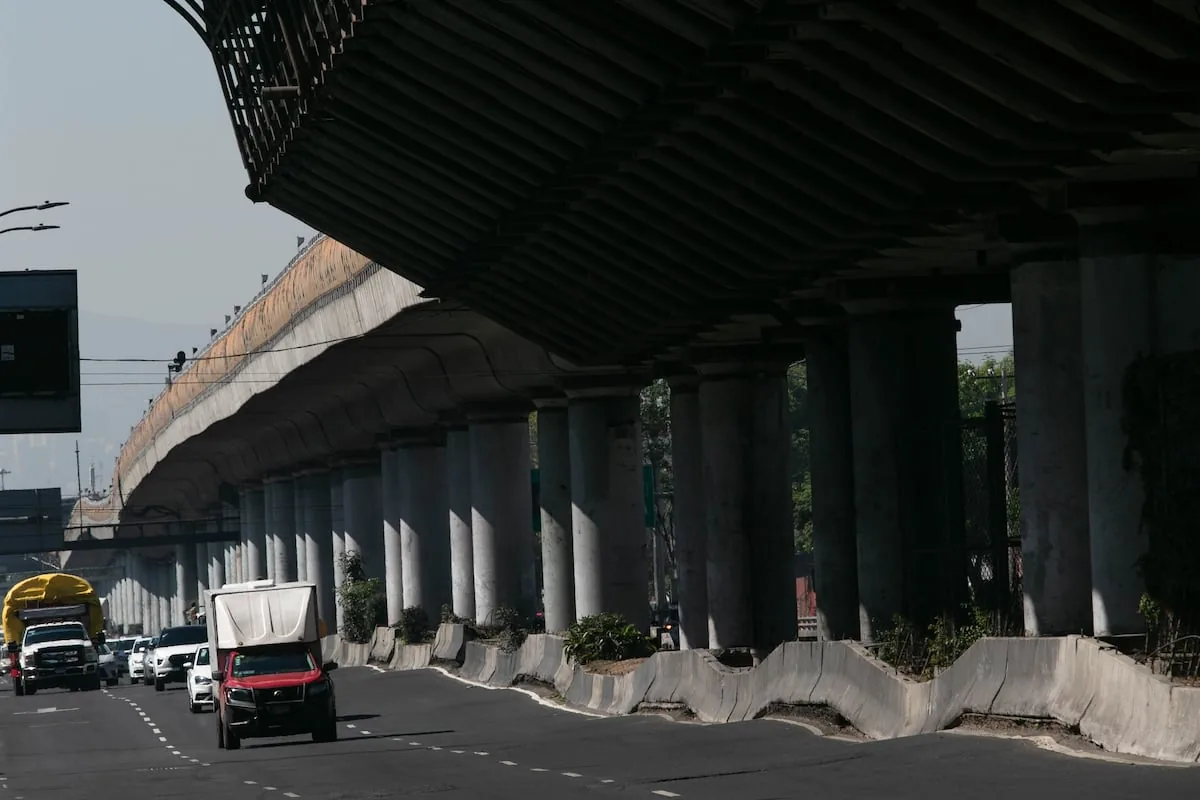
Beyond the figures, this phenomenon has repercussions on the city’s infrastructure and urban services, from transportation to water supply. “Very rapid subsidence can cause faults, fractures, and cavities in the subsurface, which causes much of the city’s critical urban infrastructure to be affected, such as the metro, drainage systems, transportation, roads, even houses in several areas of Mexico City are indirectly affected by this process. In the long term, subsidence (the progressive sinking of a surface) also has implications for the supply of drinking water for Mexico City,” warned Cabral.
Read more Trump deepens his rift with NATO and withdraws 5,000 soldiers from Germany
In the capital, the main source of water is not the Cutzamala System, as is often believed, but the subsurface. Specialists point out that about 70% of water for human consumption comes from aquifers, whose overexploitation — along with the city’s geological conditions — is directly related to ground subsidence.
Unlike other phenomena such as earthquakes, ground subsidence progresses gradually, with effects that accumulate and can go unnoticed. “An earthquake occurs and after a few minutes the buildings have already collapsed. Ground subsidence allows a bit more adaptability from society. It is such a common, everyday problem that we have become accustomed to seeing this type of news: all the metro relocations, potholes in the streets, the appearance of sinkholes, all of that is somehow related to the subsurface and subsidence. It will not produce effects as catastrophic as an earthquake, but it will have consequences that accumulate over time. Since it is a relatively slow phenomenon, it is very difficult to economically quantify the consequences,” Rojas mentioned.
For the expert who has dedicated the last decade to studying the capital’s subsidence, the problem is not solved, but rather addressed constantly through interventions, repairs, corrections in buildings and structures to avoid serious risks in the medium term.
Subscribe to EL PAÍS Mexico’s newsletter and to the WhatsApp channel and receive all the key information about the current events of this country.
Read more How much do you know about the players called up to the Mexican national team?