









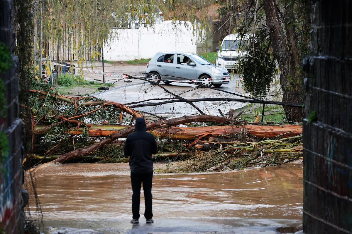
The El Niño phenomenon continues to hit Chile with new unusual and extreme weather events. After the destructive frontal systems that affected the southern, central, and norte chico areas last July, the emergency has now moved to the so-called norte grande, in the regions of the far north of the country. Alerts have been mainly activated in the Antofagasta region, where the heart of the Atacama desert is located, and which is under a meteorological alarm. Cities such as Antofagasta and Tocopilla expect rains that will be abundant for an area of the country known for being dry for much of the year.
Read more These Bosch refrigerators combine direct discount and cashback to save more
How long will it rain in northern Chile?
The Chilean Meteorological Directorate (DMC) has reported that in the city of Antofagasta the rains will continue at least until the night of Tuesday, August 18. The same will happen in Arica, Iquique, and Copiapó, where precipitation is expected to extend until Tuesday night. In La Serena, in the Coquimbo region, rain is expected to stop during Monday night.
Which areas of northern Chile will have rain?
This frontal system will affect with special force the coastal towns of the regions of Arica and Parinacota, Tarapacá, Antofagasta, Atacama, and part of Coquimbo.
Heavy precipitation will be recorded in the provinces of Antofagasta and Tocopilla, in the municipalities of Tocopilla, Mejillones, Antofagasta, and Taltal, although it is estimated that in the pampa (in the inland area, in the middle of the desert) moderate rains will fall and even snowfalls in the pre-Andean foothills.
When will the rain be most intense?
According to the DMC forecast, in Antofagasta the days of most intense rain are estimated to be Monday and Tuesday, with estimated precipitation amounts between 15 and 25 millimeters, a high record for a desert area. The pulses of greatest intensity will be recorded during Monday afternoon and night, with probable thunderstorms and winds between 25 and 40 kilometers per hour.
What does the meteorological alarm say?
The meteorological alarm for the coast of the Antofagasta region has been decreed due to a segregated low that will bring intense precipitation. The DMC has described the meaning of the alarm state and what it implies for the affected areas. “[There is an alarm when] meteorological phenomena with an intense severity degree are forecast, with a very high potential to generate material and life risks for people. Stay informed, follow the instructions issued by the authorities, and be prepared for extraordinary measures,” says the entity.
Will there be rain in the main cities of the north?
Yes. The most affected city will be Antofagasta, with rains that could even reach 25 millimeters during Tuesday early morning. Arica, in the far north, will have precipitation between 5 and 15 millimeters at the end of Monday, in an identical scenario for Iquique, in Tarapacá. In Atacama, Copiapó will record rain between 8 and 12 millimeters during Monday night. Coquimbo and La Serena, the cities most damaged by the bad weather front in July, will have precipitation between Monday night and Tuesday early morning reaching between 15 and 25 millimeters.
When will dry weather return?
On Wednesday, August 19, precipitation will end, although cloudy skies will prevail. During that day the city of Arica will see some rays of sun in the afternoon, with a maximum temperature reaching 20°. In Antofagasta, the end of the rains will also come with abundant clouds and few moments of clear sky. Between Thursday and Friday, the city will register minimum temperatures of 14° and maximums of up to 18°.
Read more The virtual and mobile office of the Govern handles 5,000 requests in four months