








The weather outlook in Spain becomes complicated in the coming hours and days, as described by José Luis Camacho, spokesperson for the State Meteorological Agency (Aemet): the storm located off Galicia moves to the Bay of Biscay while “a new depression forms west of Portugal” that will affect Spain on Wednesday and Thursday and, aloft, the trough off the Atlantic coast “deepens due to the appearance of a powerful polar jet at its rear with consequences in the western half of the country.” Meanwhile, the eastern half enjoys stability this Tuesday after the violent rains recorded on Monday in Catalonia and Aragon associated with storms, wet microbursts, and large hail.
Read more Riki Blanco: mosquitoes of Padrón
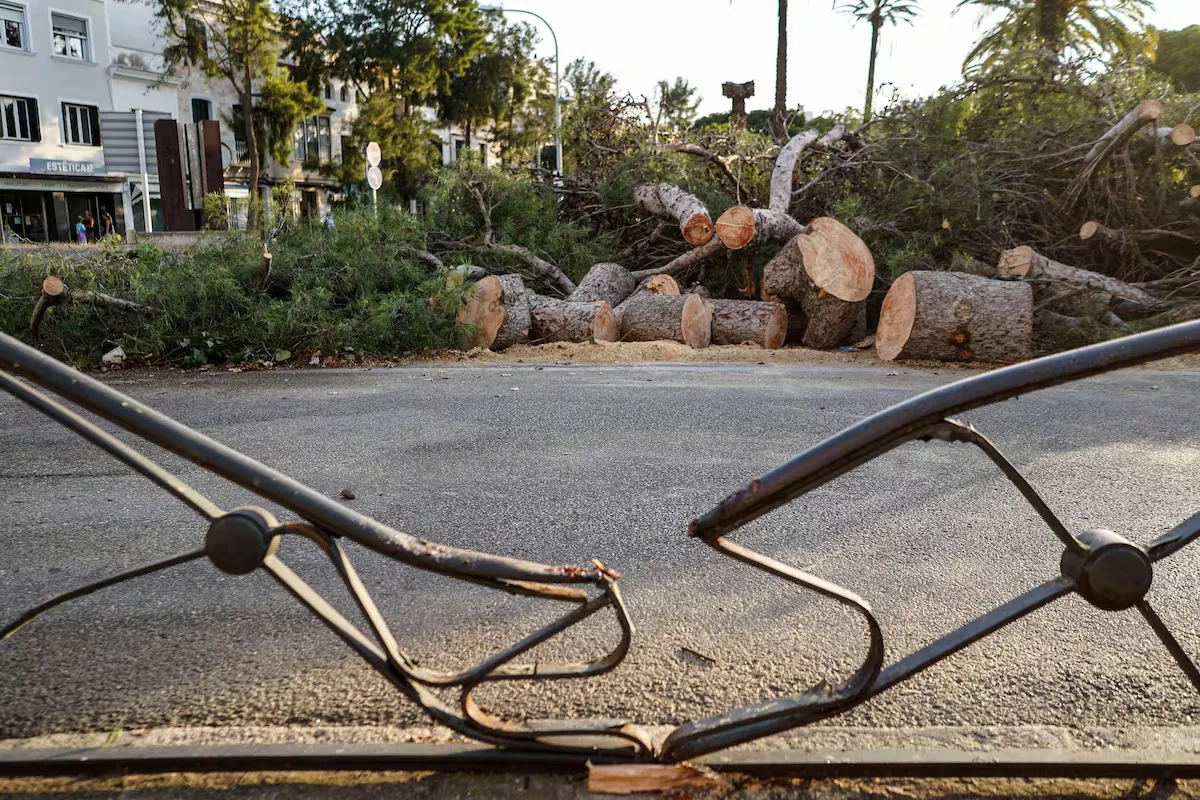
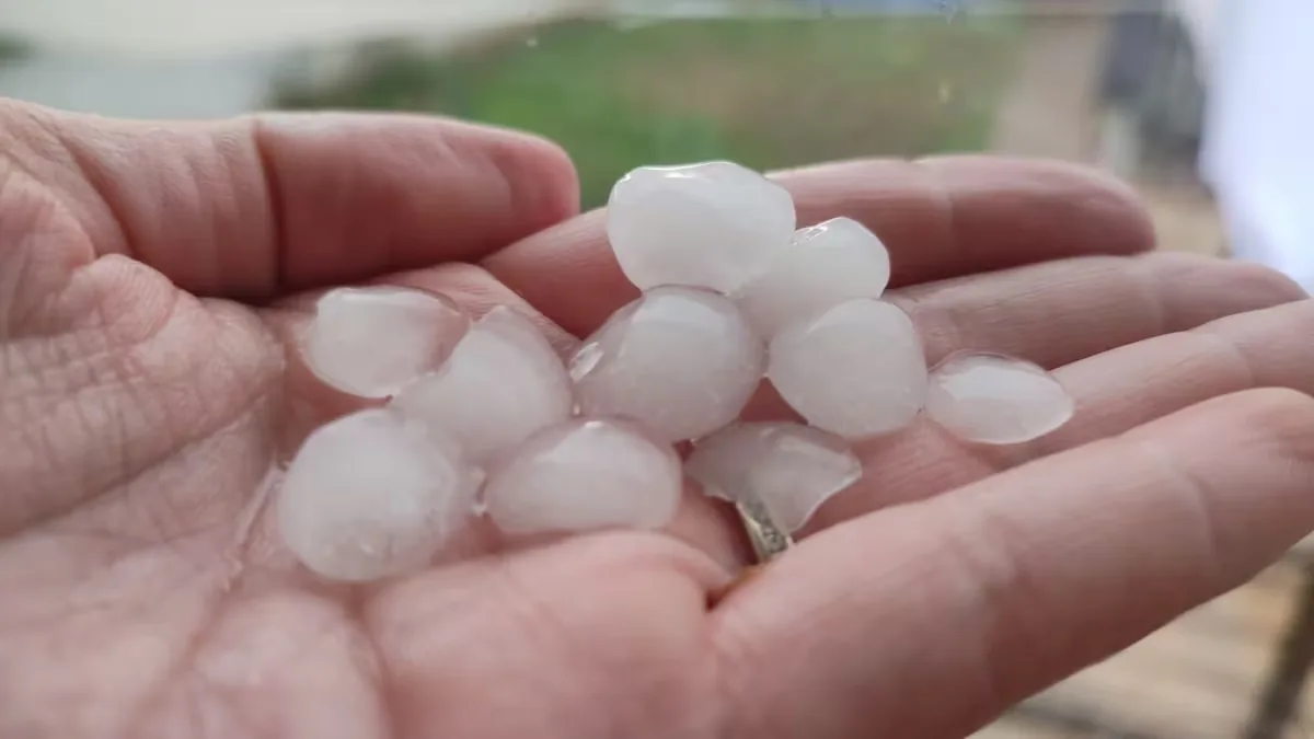
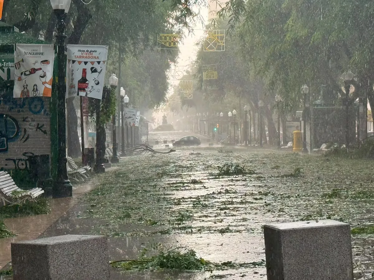
In Tarragona, it seemed like the world was ending. Trees were uprooted, houses and parking lots flooded, roads closed, trains suspended, a hundred pigeons dead in the Port, and intense hail caught many drivers in their cars without Es-Alert warnings. In southern Tarragona, according to Aemet data, hail up to nine centimeters fell, the diameter of a tuna can. In the capital, up to 77.4 liters per square meter were collected in 24 hours divided into two very intense episodes during the afternoon: in the worst, at 16:00, 25.2 liters per square meter fell in 10 minutes, there were wind gusts of 53 kilometers per hour and a sharp drop of seven degrees in temperature, that is, a full wet microburst. Also associated with storm microbursts, a gust of 109.4 km/h occurred in Cerler (Huesca) and, on the coast of Gandia, Cullera, or Xàbia, there were meteotsunamis or rissagas ―sudden changes in sea level caused by changes in atmospheric pressure.―.
A supercell ⛈️ leaves large hail and extreme winds in #Tarragona. pic.twitter.com/V6KMwmOGiZ
— Meteored España (@MeteoredES) August 24, 2026
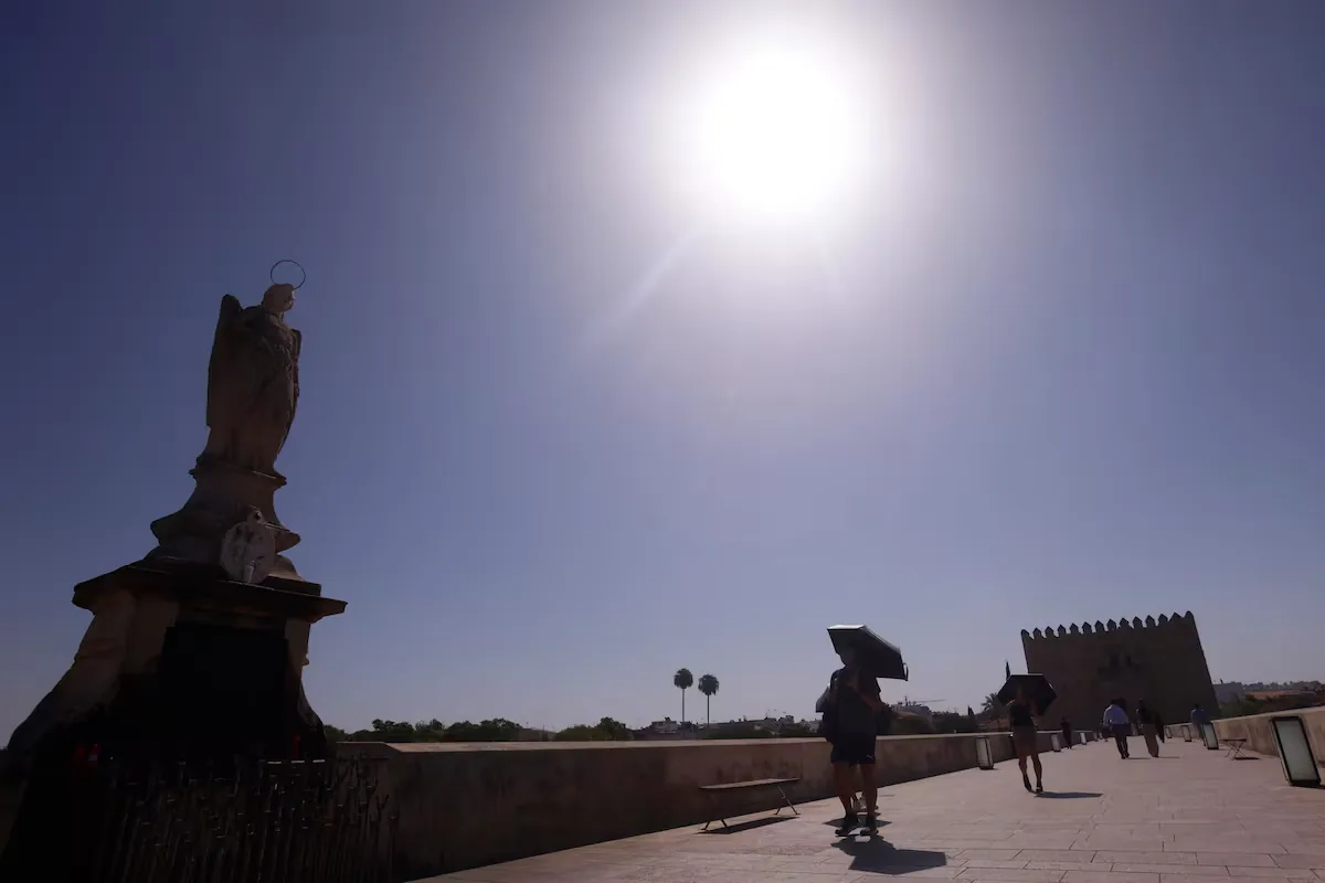
This Tuesday, the focus shifts from east to west and the most notable phenomena will be “showers and locally strong storms in Asturias and northeastern Galicia.” In the Mediterranean, “there will be high temperatures in the Balearic Islands, the coast of Valencia, and southeastern peninsular regions” while in the Basque Country and Cantabria “there will be a notable drop in maximum temperatures in a new sequence of rises and falls in a short time,” summarizes Camacho. In detail, the skies “will be cloudy or very cloudy in the northwest, Cantabrian region, and the western Central System, with light to moderate rains, which in Asturias and northeastern Galicia can be strong and with storms and accumulations of 15 liters per square meter in one hour. As for the Balearic Islands and the rest of the Peninsula, it will be mostly clear.
Maximum temperatures will drop in Galicia and the Cantabrian region, even notably ―at least six degrees―, and in the northern plateau, with maximums barely reaching 25-26°, and will rise in the Balearic Islands and the rest of the Peninsula, especially on the Mediterranean coasts and Andalusia, where they may exceed 35°. Minimum temperatures will drop generally, especially in the eastern half of the peninsula except “on the Mediterranean coasts due to the high sea water temperature.” Regarding fire risk, very high danger in areas of the eastern interior, eastern Catalonia, and the Balearic Islands. There are only three warnings, all yellow, the lowest level, for rain in Asturias and heat in the Valencian Community and Balearic Islands.
🌀 A new storm will affect Spain Wednesday and Thursday.
⛈️ Rain in the northwest peninsula, abundant and with strong storms in Galicia.
🌬️ Very strong wind gusts in the northern peninsula.
🌡️ Thermal drop on Thursday, but heat in the eastern peninsula and Balearic Islands. pic.twitter.com/piNKnTs5YE
— AEMET (@AEMET_Esp) August 25, 2026
On Wednesday, the storm northwest of Galicia “will deepen and send a cold front that will sweep most of the Peninsula, associated with a very marked upper trough and with wind maxima that can cause severe phenomena.” Broadly, “showers and strong storms with hail and significant accumulations are expected in the western half of Galicia, very strong wind gusts in points of the northern plateau and northern mountains and, by contrast, high temperatures in the Ebro, eastern Cantabrian, and Balearic Islands with a notable rise in maximums in the eastern Cantabrian.”
In detail, the skies “will be cloudy or overcast in Galicia with persistent precipitation in Rías Baixas and the Miño valley and accumulations of 15 liters in one hour and totals of 40 in 12 hours.” These precipitations, warns Camacho, may have “intervals of storms with possible hail formation.” In the western Cantabrian, western half of the northern plateau, and Gredos also overcast skies with precipitation and occasional storms; cloudy with risk of light precipitation in Extremadura and northern Huelva and, in the Pyrenees, stormy showers in the afternoon.
Read more Peridis: helpers for evictions
Regarding temperatures, Spain will be split in two, with high temperatures on the Mediterranean coast, Balearic Islands, and Ebro valley, even up to the interior of Gipuzkoa and points in Navarra, where they will exceed 35°. This thermal contrast and the front’s advance “may cause some intense wind role phenomenon in the Cantabrian [galerna] in the second half of the day.” On the Mediterranean coast, isolated showers in the northern half and risk of rissagas in Mediterranean ports, with a yellow level warning for Menorca.
Regarding fire risk, there will be a temporary worsening of the situation in the center and east, with very high or extreme danger in much of the central-eastern peninsular strip due to high temperatures and wind. On the warning map, yellow for rain in Galicia and for heat in Aragon, Navarra, Basque Country, and La Rioja.
On Thursday, “showers and strong storms with significant accumulations in southwestern Galicia and, in the afternoon, strong showers and storms in the Pyrenees.” High temperatures in the interiors of the eastern third and Balearic Islands and a notable drop in maximums in the peninsular interior due to “the entry of a polar air mass from the west.”
Many ups and downs in the🌡️of the coming days; autumnal values until Friday, although heat will continue in the eastern peninsula and Balearic Islands; notable⬇️on Thursday and Friday, and⬆️on the weekend, which will leave temperatures more in line with the calendar. #ClimaEnMapas.https://t.co/nhTwWia7rL pic.twitter.com/jlT5I6vAfH
— CésarRgzBallesteros (@crballesteros) August 25, 2026
It is expected, details the Aemet spokesperson, “an unstable day marked by a storm located around the British Isles, although there is uncertainty regarding its exact position.” The fronts associated with this storm are expected to “cross the northwestern half of the peninsula and leave very cloudy or overcast skies and locally strong precipitation, accompanied by storms and persistent, especially in southwestern Galicia.” These rains “may extend to the southwest of the Peninsula and to the northeastern and Balearic coasts” and even “some weak afternoon showers in the southeast and, by diurnal evolution, in the Pyrenees, where they may be locally strong and accompanied by storms.” In the Canary Islands, the tail of a front will gray the skies of the northern islands and leave locally moderate precipitation in the more mountainous ones.
Maximum temperatures “will drop almost generally, even notably, in interior peninsular areas; on the contrary, on the coasts, Mediterranean prelittorals, and in the Canary Islands they will remain unchanged or rise.” In figures, they may exceed 35° in points of the Ebro valley, Mallorca, the Levante prelittorals, and low areas of the southeast. Minimums will also “drop in the interior, with some rises in the southwest and Balearic Islands and no changes in the rest.” There will be intervals of locally strong wind, with some very strong gusts in mountain areas of the northern half. In the warnings, orange for rissagas in the Balearic Islands and yellow for rain and storms in Galicia.
Read more Last names well placed